


Verified View/s: Is an accurate Photomontage of a proposed design/building, using the Guidelines for Landscape and Visual Impact Assessment (GLVIA3).
Photomontage in 3d Visualization: Is the process of incorporating a 3d object/design/building into a 2d image/photo, while matching the camera angle/settings, position and the overall lighting depicted in the 2d photo.
This laborious process often requires the usage of a 2d and a 3d application.
To create an accurate Photomontage/Verified View, the 3d Visualizer/specialist needs a: 3d context model to plot/plan the shots; a photo of the location in question; the survey data; camera information; a 2d and a 3d application to create the Final Verified View/s .
Some of the articles, Videos and Tutorials depicted here will take you through the process.
Planning Applications: These can be used to find out whether a proposed development is likely to be approved by the planning authority, before substantial costs are incurred developing a detailed design.
Planning Permissions: Is the legal process of determining whether proposed developments should be permitted. Responsibility for planning lies with local planning authorities (usually the planning department of the district or borough council). The legislation, policy and guidance that underpins planning in England can be found on the government's National Planning Practice Guidance.
Accucities : The ultimate destination for accurate 3d context models for Planning Applications
Detailed 3D context models are crucial during the process of creating Accurate Visual Representations in C G I (computer generated Images) for Planning Applications .
3D context models are fundamental for Planning applications for the following reasons :
1- They help Planners and Architects Pre-Visualize the proposed camera views in CGI and/or in VR (using Accucities VR app) prior to sending the Surveyor and the Photographer to the physical location .
This mandatory Pre-visualisation process will help Planners and Architects/Developers Save a Substantial amount of time and money, by eliminating any potential camera revisions that might have occurred after sending the Surveyor and the Photographer to the physical location .
 |
| 3D Model of London AccuCities Sample Tile 1 |
2- After the Photographs and the Survey data have been taken, it's quicker and easier to Align the 3d context model with the photos during 3d camera matching process

 |
| Aligning the Photo with a Survey Data in 3ds max |
 |
| Final CGI (Computer Generate Image) submitted for Planning Application |
 |
| 3D Model of London AccuCities Sample Tile 2 |
Having detailed and accurate 3d context models makes it quicker, easier and more accurate to Align and match the CG cameras against the Survey Points ; hence creating more Accurate Visual Representations for Planning Applications .
More often than not , some of the Survey Points seen in a Photo might be focused on detailed areas of a building facade or object.
If your 3d context model isn't accurate and doesn't include some of the details seen in photo with survey points , then the process of camera matching in 3d will become extremely laborious and less accurate.
For this reason alone it's exceptionally important to have detailed context models for close-ups of Accurate Visual Representations for Planning Applications .
Accucities provide users with Four detail levels of accuracy: Level 1 , Level 2 , Level 3 & Level 4
 |
| Free 3D Model of London Tile Medium Detail Level 2 |
 |
| Free 3D Model of London Tile Medium Detail Level 3 |
 |
| Free 3D Model of London Tile Medium Detail Level 4 |
For Distant Views , most companies use Level 2 3d context models
For close-ups , Level 3 is best suited .
However, Level 4 comes with textures and facade details
 |
| Level 4 with textures |
 |
| Level 4 with textures and facade details |
Level 3 and Level 4 models have a 15 cm accuracy in all axis
Accucities 3d context models are available in file formats such as , SKP, CAD, FBX , 3ds Max , Autocad , Sketchup , Revit , etc
I addition, every 3d context model file/scene is uniquely organized in separate layers such as:
Buildings , Roads , Green spaces , Bridges , Rivers, Trees , etc.
 |
| AccuCities 3D Model Layers |
To Get a Quote for a specific area, simply go to : https://www.accucities.com/buy-3d-models/
 |
| Accucities website |
Click on the Get a Quote For Custom 3ds models button
 |
| Accucities Get a Quote |
In the quote page, type in the street name or simply Zoom in to the desired area
Next, click on the Draw Shape button
To be begin drawing, click one polygon at the time to create a shape and close it
 |
| Accucities Draw a Shape |
Once the shape is created, you can move shape by left clicking and moving the Shape
To restart the shape, simply click on the Clear Shape button
Once satisfied, simply type in your details and click Send

3d context models of London are delivered within a day of making a request. Otherwise, up to six days, maximum.
Accucities operate in United Kingdom mainly.
However, they can produce accurate 3d context models for most parts of the world.
You can download Free 3D Model samples of London , which cover 500 x 500 meters in real world
Level 3 High Detail 3D Model of London is available in Central London
For More info simply visit: https://www.AccuCities.com
To explore the overall process of Verified Views for Planning applications, please visit the following websites:
Verified Views Methodology
GLVIA (Guidelines for Landscape and
Visual Impact Assessment)
In addition, it's worth checking its visualisation page/tab guidelines
Government Pre-Application Advice
Mandatory Documents
I hope you have found this article somehow useful!


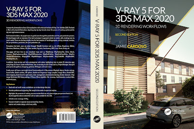
Finally, I have just published a New Book with Taylor & Francis/CRC Press, entitled,
V-Ray 5 for 3ds Max 2020: 3D Rendering Workflows
Click on the image below to find out more about my new book.
Checkout below my other Courses with High Resolution Videos, 3d Project files and Textures included.
 |
| Course 1: Exterior Daylight with V-Ray + 3ds Max + Photoshop |
Course 2: Exterior Night with V-Ray + 3ds Max + Photoshop |
| Course 4: Interior Daylight with V-Ray + 3ds Max + Photoshop |
 |
| Course 5: Interior Night with V-Ray + 3ds Max + Photoshop |


 |
| Course 8: Planning Applications for Verified Views |
Also, please Join my Patreon page or Gumroad page to download Courses; Project files; Watch more Videos and receive Technical Support. Finally, check my New channels below:


No comments:
Post a Comment